The Advantages of Using Aerial Photography for Real Estate
April 22, 2019
Leave your thoughts
If you’re still surveying large plots of land on foot, you’re doing it wrong! Nowadays, the best real estate agents and appraisers use helicopters and aerial photography to get an accurate view of the land. Continue reading to learn just a few of the reasons why more and more professionals take advantage of real estate survey flights in Montana:
- Reduce survey time: First and foremost, going up in a helicopter for a survey cuts back drastically on the amount of time you spend surveying land. Instead of spending days scoping out a plot of land, you could do the same job in a matter of hours. Think of all the other things you can start working on if you’re not walking around a piece of property all day!
- Save money on surveys: Think about it—if you reduce the amount of time you spend conducting surveys, you’ll also reduce the amount of money you spend on these surveys! Though these real estate survey flights aren’t free, they’re much more cost-effective than paying someone to survey your land on foot all day long.
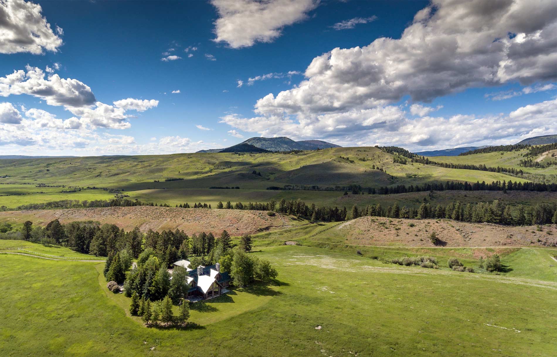
- More thorough and accurate assessments: Saving time and cutting costs often means that you’re getting a lower-quality product. That’s not the case when you choose to take a survey flight. Getting a bird’s-eye view of the property and taking high-quality images provides you with a better appraisal and understanding of the land. We guarantee you’ll have a more complete knowledge of the whole property once the flight has ended.
- Quickly see surrounding features: It’s not just the land itself that you’re looking at when appraising a plot. Instead, you want to know the natural and manmade features surrounding the property, like creeks and roads. Though you can do that on foot, it’s quite time-consuming! Instead, hop in a helicopter and get a view of everything surrounding the property without having to hike all around.
- Help with mapping and planning: Needless to say, you’ve got a lot of work ahead of you if you’re trying to develop a whole neighborhood instead of just one house. Where will roads go? How big should each plot be? Is there anywhere that you can’t build? These are just a few of the things you need to know before breaking ground. Though it’s not impossible, this process could take a whole lot longer if you don’t get a bird’s-eye view of the land.
- Marketing advantage: These real estate survey flights in Montana are crucial before you break ground on land, but they’re not just for pre-development. Taking photos from above can really boost your chances of selling these properties once they’re done. An aerial image is often a lot more impressive than one taken from the ground, which means more folks are likely to buy.
If you need to check out a plot of land, be sure to take a real estate survey flight, and be sure to hire Rocky Mountain Rotors to take you up in the sky. We guarantee safe and cost-effective real estate survey flights in Montana for all of our clients. Give us a call today to learn more about our services or to schedule a flight.
Categorised in: Real Estate Survey