The Advantages of Using Real Estate Survey Flights in Montana
Listing a piece of property for sale can be a massive undertaking. It involves inspections, consultations, maintenance and repair work and all of the other preparations and procedures that are necessary before a property can go to market. An accurate real estate survey is important when it comes time to list your home or piece of land on the real estate market. Real estate surveying options include aerial satellites, remotely operated drones, mapping from land surveyors and helicopter surveys.
There are many advantages of using professional helicopter real estate survey flights in Montana over other methods of land surveying. Let’s take a look at four of them:
- Quality mapping imagery: Most people can capture an image of a bird’s eye view of their land from aerial survey satellites. Although these satellite images can be useful, their quality is generally relatively low compared to the kind of mapping that can be achieved through the use of helicopter surveying services. You can even utilize software to stitch together high-quality photos to create a realistic, three-dimensional set of images.
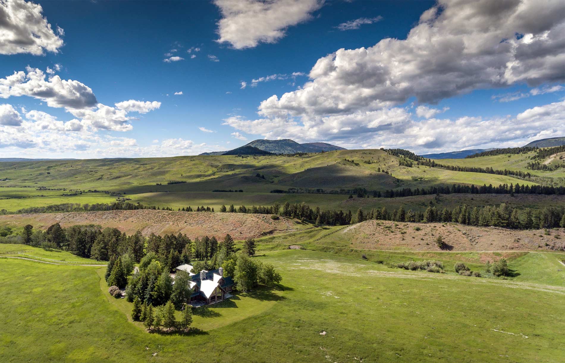
- Site planning: The detailed images and mapping information that can be obtained from an aerial land survey can be incredibly useful when it comes to site planning. Aerial images can provide scope, scale and size, which are all helpful during the selling process. Aerial surveys can also reveal landscape features that might have a bearing on potential development or construction. In addition, the images gathered from surveys can be included in the property listing to give potential buyers an idea of the scale of the land and its size in relation to any buildings, homes or other structures that are on the property.
- Inspection safety: Aerial surveys are an excellent tool that can be used to assess the condition of roads, bridges, buildings, roofs and other physical structures on the property. You may be able to identify problems and maintenance concerns that were not apparent from the ground. The ability to inspect things from the air minimizes the need for hands-on inspections that can be difficult to perform, time-consuming and, in some cases, hazardous.
- High quality photography: Quality images make a listing stand out and can give potential buyers a better idea about what your property has to offer. From a helicopter, you can capture a sweeping perspective and beautiful landscape views to appeal to buyers. These photographs offer a point of view that you would not otherwise be able to capture with traditional property photography.
If you’re interested in finding out more about the advantages of real estate survey flights in Montana, our team at Rocky Mountain Rotors is here to assist you. We offer a variety of helicopter services, including private and commercial charters, helicopter photography tours and aerial real estate surveying. We have a variety of different helicopter options to accommodate your specific needs. Give us a call today or send us an email to schedule our exceptional services. Our trained mountain pilots would be happy to help you with your aerial real estate survey!
Categorised in: Real Estate Survey