Four Advantages of Doing Real Estate Survey Flights in Montana
Real estate surveys are a good idea for anyone thinking about buying a parcel of land, selling a piece of land or even a current homeowner who just wants to know more about their property. A survey can tell you exactly where your property or the property you’re thinking about buying or selling starts and ends. It can also reveal some other facts about your land that you may never have found without the assistance of a professional surveyor. While surveys from the ground certainly help, there’s no better way to gauge a property than from the air. Here are a few reasons to conduct real estate survey flights in Montana.
Survey flights are faster
An aerial survey of a piece of land is always going to be a faster process than hiring someone on the ground to walk around and check your property out. This is especially true if you have a large piece of land. Large parcels of land, which are often found in Montana, can take days to properly survey from the ground. However, if you were to a helicopter service to help survey the land, the process would be much shorter.
Survey flights require less manpower
Along with being faster, hiring a helicopter service to conduct real estate survey flights in Montana is obviously going to require less manpower. In order to get a ground survey done in the same amount of time as an aerial survey, you have to hire quite a few surveyors to get the job done. This will be a more time consuming process, and could cost you more money. Surveyors don’t work for free, and the more you need to hire, the more they’ll charge you.
Survey flights can be more accurate
As previously mentioned, the larger your property is, the harder it is to survey from the ground. Surveyors can easily make mistakes that can wind up causing problems when your property is up for sale or being appraised. A surveyor looking down from the sky will be able to spot everything from above and make better judgments about your land.
Survey flights show more of the property’s amenities
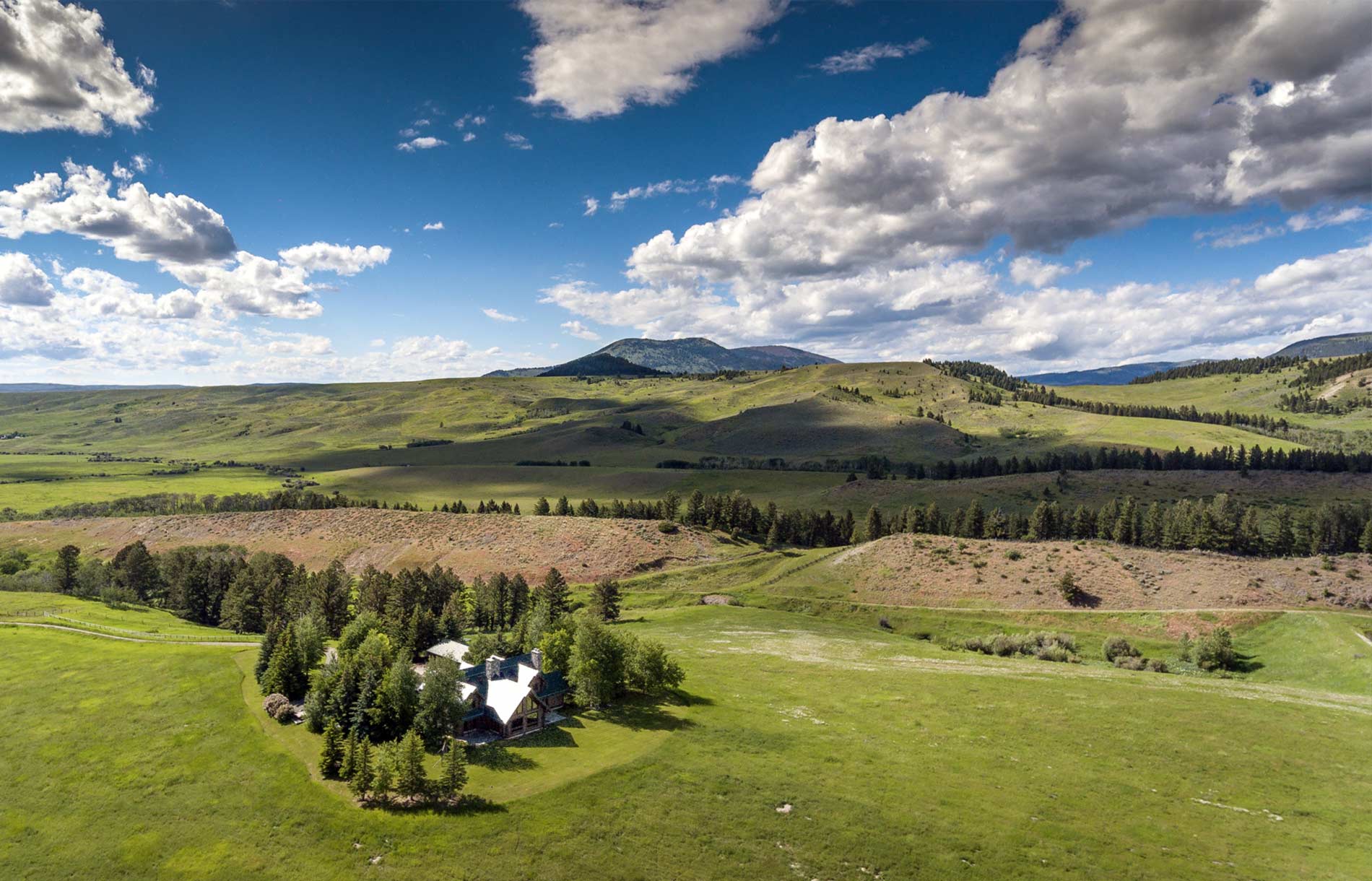
If you’re trying to sell a large and expensive piece of land, you want the potential buyers to know what they’re getting for their money. For example, if you live near a lake, you want the buyers to be able to see how close the lake is to your home. The easiest way to do that is by showing buyers an aerial view of your property. If you’ve increased the value of your property by adding gardens or other amenities buyers might appreciate, you’ll definitely want buyers to be able to see those additions from the sky. Also, buyers who might be looking for some privacy will be able to clearly visualize how far away their potential new neighbors will be.
If you’re interested in real estate survey flights in Montana, contact Rocky Mountain Rotors today to learn about our services.
Categorised in: Real Estate Survey